Oxford Cycle Map
Created by Oxford resident and Director of Transport Paradise, Richard Mann, the Oxford Cycle Map is extremely useful for getting around.
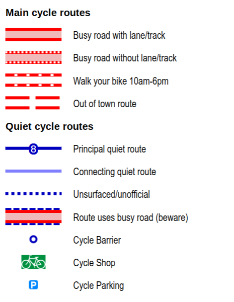
The map details main cycle routes, areas where you are required to dismount, road surfaces, as well as marking out routes that are generally busy and quiet. Cycle barriers, local bike shops and and cycle racks are also noted:
The is an interactive version of the map online. Printed copies are available to buy for £1 from Cyclox stalls, or you can join us and receive a free copy in your welcome pack.
5 Responses
[…] for alternative transport. The recipients were not only given a bike but also a lock, lights, a cycling map of Oxford and information on how to maintain their bikes. Those who were wobbly, or unsure, were offered free […]
I am visiting Oxford for one day and would have liked to be able to download a map of cycle routes.
Thanks
[…] filters (barriers) and — consequently — Low Traffic Neighbourhoods (LTNs). Cyclox part-funded the Oxford Cycle Map, created by Oxford resident and Director of Transport Paradise, Richard Mann. The map details main […]
[…] to talk about the challenges experienced by everyone who cycles in Oxford. Our big laminated map of cycle routes around the city is a focus of attention. People pore over it, looking at the routes they take and […]
[…] has been giving a paper copy of the Oxford Cycle Map to each key worker in receipt of a donated bike for exactly this reason – we want people who are […]
Comments are closed.